
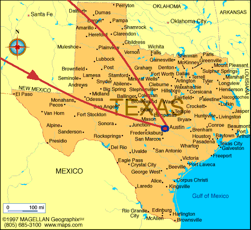
Texas - Austin - History/Geography ~ 2011.05.10
Texas Flag
Texas Flag
![]()
|
|
Texas - Austin - History/Geography ~ 2011.05.10 |
|
|
Texas Flag |
Texas Flag |
|
|
|
||
|
|
||
|
Texas History
Spanish explorers, including
Álvar Núñez Cabeza de Vaca and
Francisco Vásquez de Coronado, were the first to visit the region in
the 16th and 17th centuries, settling at Ysleta near
El Paso in 1682. In 1685,
Robert Cavelier, Sieur de la Salle, established a short-lived French
colony at
Matagorda Bay.Americans, led by
Stephen F. Austin, began to settle along the
Brazos River in 1821 when Texas was controlled by Mexico, recently
independent from Spain. In 1836, following a brief war Possessing enormous natural resources, Texas is a major agricultural state and an industrial giant. Second only to Alaska in land area, it leads all other states in such categories as oil, cattle, sheep, and cotton. Texas ranches and farms also produce poultry and eggs, dairy products, greenhouse and nursery products, wheat, hay, rice, sugar cane, and peanuts, and a variety of fruits and vegetables. Sulfur, salt, helium, asphalt, graphite, bromine, natural gas, cement, and clays are among the state's valuable resources. Chemicals, oil refining, food processing, machinery, and transportation equipment are among the major Texas manufacturing industries. Millions of tourists spend well over $44 billion annually visiting more than 100 state parks, recreation areas, and points of interest such as the Gulf Coast resort area, the Lyndon B. Johnson Space Center in Houston, the Alamo in San Antonio, the state capital in Austin, and the Big Bend and Guadalupe Mountains National Park. Austin History Austin, the state capital of Texas and seat of Travis County, is the fourth-largest city in Texas. It is situated in the south-central part of the state on the Colorado River. The site was called Waterloo in 1838, and in 1839 it was incorporated as a city and chosen as the capital of the independent Republic of Texas. Waterloo was renamed Austin in honor of Stephen F. Austin, the founder of the Texas Republic. It became the permanent capital of the state of Texas in 1870. After the Civil War the railroads reached the city in the 1870s; it was crossed by the important Chisholm cattle trail; and it became the seat of the state university in 1883.Austin has a growing commercial and diversified manufacturing sector. Civilian government employment is 20% of the labor force and is important to the economy. University of Texas, Austin is a major center for research and development and is nationally recognized as a high-technology center. Austin's visitor attractions include the Austin Museum of Art, the Lyndon B. Johnson Library and Museum, the Lady Bird Johnson Wildflower Center, and the Austin Zoo. Geography Gulf CoastThe industrial heart of the coastal area is Houston, the fourth largest city in the nation. Houston's development was spearheaded by the digging (1912–14) of a ship canal to the Gulf of Mexico, and the city today is the nation's second largest port in tonnage handled. Other Gulf ports in Texas are Galveston, Texas City, Brazosport (formerly Freeport), Port Lavaca, Corpus Christi, and Brownsville. The S Gulf Coast is a popular tourist area, and some of the ports, such as Galveston and Corpus Christi, have economies dependent on both heavy industry and tourism. Brownsville, the southernmost Texas city and the terminus of the Intracoastal Waterway, is also the shipping center for the intensively farmed and irrigated Winter Garden section along the lower Rio Grande, where citrus fruits and winter vegetables are grown. Rio Grande ValleyThe long stretch of plains along the Rio Grande valley is largely given over to cattle ranching. Texas has c.1,000 mi (1,610 km) of border with Mexico. Some S and W Texas towns are bilingual, and in some areas persons of Mexican descent make up the majority of the population. Laredo is the most important gateway here to Mexico, with an excellent highway to Mexico City and important over-the-border commerce. Blackland PrairiesThe first region to be farmed when Americans came to Texas in the 1820s was the bottomland of the lower Brazos and the Colorado, but not until settlers moved into the rolling black land prairies of central and N central Texas was the agricultural wealth of the area realized. The heart of this region is the trading and shipping center of Waco; at the southwest extremity is San Antonio, the commercial center of a wide cotton, grain, and cattle country belt. To the north, Dallas and the neighboring city of Fort Worth together form one of the most rapidly developing U.S. metropolitan areas. Their oil-refining, grain-milling, and cotton- and food-processing capabilities have been supplemented since World War II by aircraft-manufacturing and computer and electronics industries. High PlainsThe Balcones Escarpment marks the western margin of the Gulf Coastal Plain; in central Texas the line is visible in a series of waterfalls and rough, tree-covered hills. To the west lie the south central plains and the Edwards Plateau; they are essentially extensions of the Great Plains but are sharply divided from the high, windswept, and canyon-cut Llano Estacado (Staked Plain) in the W Panhandle by the erosive division of the Cap Rock Escarpment. No traces of the subtropical lushness of the Gulf Coastal Plain are found in these regions; the climate is semiarid, with occasional blizzards blowing across the flat land in winter. The Red River area, including the farming and oil center of Wichita Falls, can have extreme cold in winter, though without the severity that is intermittently experienced in Amarillo, the commercial center of the Panhandle, or in the dry-farming area around Lubbock. Cattle raising began here in the late 1870s (settlers were slow in coming to the High Plains), and huge ranches vie with extensive wheat and cotton farms for domination of the treeless land. Oil and grain, however, have revolutionized the economy of this section of the state. West TexasAll of West Texas (that part of the state west of long. 100°W) is semiarid. South of the Panhandle lie the rolling plains around Abilene, a region cultivated in cotton, sorghum, and wheat and the site of oil fields discovered in the 1940s. The dry fields of West Texas are still given over to ranching, except for small irrigated areas that can be farmed. San Angelo serves as the commercial center of this area. The Midland-Odessa oil patch lies northeast of the Pecos River and is part of the Permian (West Texas) Basin, an oil field that extends into SE New Mexico. The land beyond the Pecos River, rising to the mountains with high, sweeping plains and rough uplands, offers the finest scenery of Texas. There are found the Davis Mts. and Guadalupe Peak, the highest point (8,751 ft/2,667 m) in the state. The wilderness of the Big Bend of the Rio Grande is typical of the barrenness of most of this area, where water and people are almost equally scarce. El Paso, with diverse industries and major cross-border trade with Mexico, is a population oasis in the region. |
||||
| link. | ||||
| San | ||||
| San | ||||
| San | ||||
|
Charles W. Buntjer |
Published on: 2011.03.28 |
|||
| San | ||||
|
San Francisco |
Updated on: 2011.03.28 |
|||
 between the
American settlers in Texas and the Mexican government, the Independent
Republic of Texas was proclaimed with
Sam Houston as president. This war was famous for the battles of the
Alamo and
San Jacinto. After Texas became a state in 1845, border disputes led
to the
Mexican War of 1846–1848.
between the
American settlers in Texas and the Mexican government, the Independent
Republic of Texas was proclaimed with
Sam Houston as president. This war was famous for the battles of the
Alamo and
San Jacinto. After Texas became a state in 1845, border disputes led
to the
Mexican War of 1846–1848.