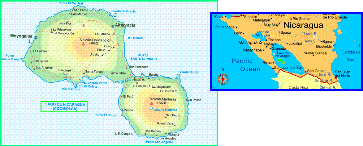
Nicaragua ~ Map of Ometepe Island & a Brief History


It's the biggest
latchstring island in the world. It's
placed inside Cocibolca lake and it's created by two big active volcanoes Conceptión
1610 meters high and Maderas 1394 meters high. Its surface is about 270
square kilometers and it has 35000 inhabitants approximately. The most
part of Ometepe inhabitants work in farming
Its name derives from the Aztec language and it means Ome= two and Tepelth=hills, due to the mountains formed by the two volcanoes. The volcanic activity, through the deposition of volcanic ash, has made the soil of the plains extremely fertile, permitting constant planting without fallowing. The island has probably been inhabited since 2000-2500 B.C.
To reach Ometepe island you can catch a boat from Granada and after 4 hours you'll arrive to Altagracia port or you can leave from Sam Jorge (Rivas port) to reach, after 1 hour you reach Moyogalpa's port. There are small wood boat that can take only people and ferry boat that can carry cars and lorries.
It's possible to make tracking in mountain bike, trips riding horses, on the slopes of both the volcanoes reaching several lagoons inside some dead craters.
The are also a many kinds of animals of which some are native plants are also archeological sites dated over 2000 years. You can find beautiful beaches of white sand where make the bathing.
Published on 2008.02.20