


 |
 |
 |
Charles Buntjer - From the Farm to the City
I was born on a farm in nothern Illinois in 1940. I always dreamed of living in the big city all of
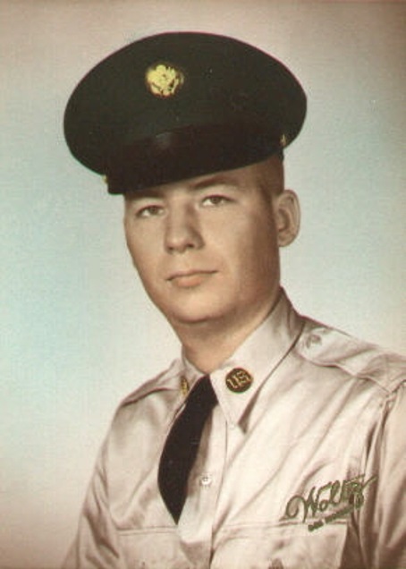 my life. My stepmother got me an interview in the summer of 1959, I was 19 years old. It was Freeport, at a huge manufacturing plant. I was hired a month later and of all things, sent to Chicago to learn how to create punched cards to store data, sort the cards for reports and wire boards to program IBM Tabulating Machines!
In 1961 I moved to Rockford Illinois, second biggest city in the state, a huge manufacturing center. I had a nice apartment and lots of friends plus my sister Yvonne and her family lived there so I was very happy. What could go wrong I thought.
In July of 1963, I was 23 years old and I thought I had it made but then got a letter from the government that I had been drafted. I was sent to Fort Knox Kentucky and was at the top of the privates in abilities, top sharp shooter, highest I.Q. and so on, but found out I was being sent to the Presidio of San Francisco to work in the computer installation overlooking the Golden Gate Bridge, Angel Island and downtown San Francisco. I knew I was never going to leave San Francisco and Utah.
I have traveled all over the world since living in San Francisco.
Utah Overview
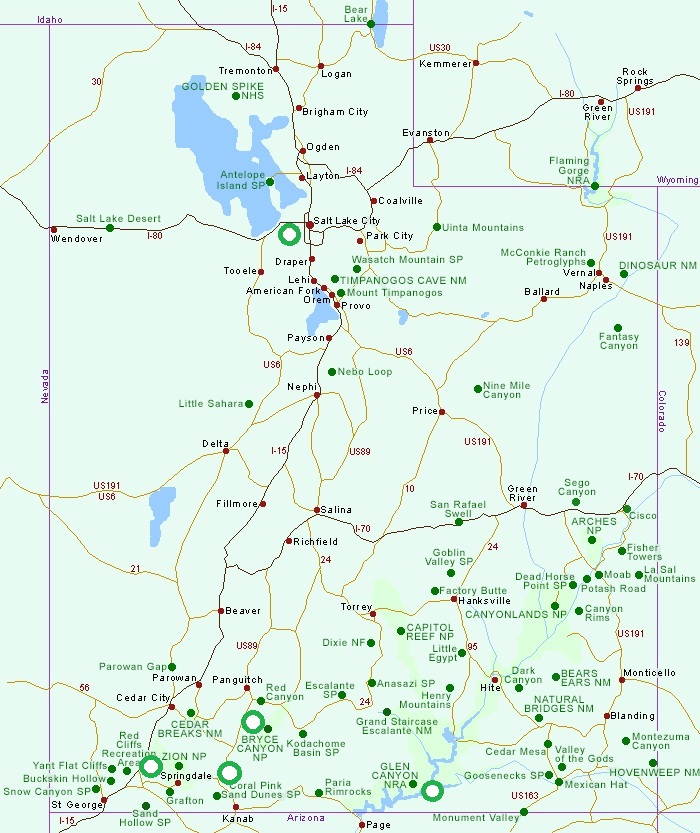
Utah is a state in the Western United States known for its diverse landscape, including mountains, desert, and the Great Salt Lake. It's home to five national parks and is famous for its skiing, particularly around Salt Lake City. Utah's economy is strong, with a focus on technology, healthcare, and tourism. The state is also known for its historical Mormon roots and the Sundance Film Festival.
Utah History
Key Milestones:
Early Inhabitants:
Native American cultures, including the Ancestral Puebloans and Fremont, thrived in the area for centuries, leaving behind evidence of their lives in pictographs and dwelling sites.
European Exploration:
Spanish explorers, including Juan Antonio de Rivera, visited Utah in the 1700s, and later, Spanish priests like Atanasio Dominguez and Silvestre Escalante traveled through the area in 1776, says Visit Utah.
Mexican Control:
After Mexico gained independence from Spain in 1821, it took control of Utah, which was then part of Alta California.
Mormon Pioneers:
In 1847, the Mormon pioneers, led by Brigham Young, arrived in Salt Lake Valley, establishing the first permanent European settlement.
Utah Territory:
Following the Mexican-American War, Utah became part of the United States, and the Utah Territory was established in 1850.
Statehood:
Utah's path to statehood was long and complex, marked by issues like polygamy, which led to delays in statehood. Utah finally achieved statehood on January 4, 1896, becoming the 45th state, says History Channel.
Golden Spike National Historical Park:
The completion of the first transcontinental railroad in Utah, marked by the Golden Spike Ceremony, had a significant impact on the region's growth and development.
History of the Flag
The state seal is the only icon on the flag, but it is rich with symbolism dating back to the days before statehood. The blue color of the flag’s field is common to many states and echoes the blue of the United States flag. The color traditionally symbolizes vigilance, perseverance and justice.
The seal is ringed by a gold circle, and just inside the circle but outside of the seal is the year 1896, the year Utah was granted statehood. The first symbol on the seal is the bald eagle. It is the national bird of the United States and symbolizes protection in both peace and war-time. The eagle is perched on a white shield that is flanked by United States flags. Utah’s flag is rare with this detail — very few state flags feature the nation’s stars and stripes. This symbol was chosen to represent the loyalty of Utah citizens to the nation. Since the state was founded by Mormons interested in creating a religious center in the American West, the Mormons were often seen to be disloyal to the United States. Utah was denied statehood for nearly 40 years due to this prejudice. This symbol cements their identity as American citizens, first and foremost. The shield itself has a beehive on the center. While there are certainly beehives in the state, this detail was chosen to represent the tireless progress and hard work of Utah citizens. The theme is strengthened with the word “industry” featured above the beehive in blue lettering. Under the beehive, there is the state name and the year 1847, which represents the year that the first Mormon settlers entered the Salt Lake Valley. The beehive is surrounded by sego lilies, the state flower.
Salt Lake City
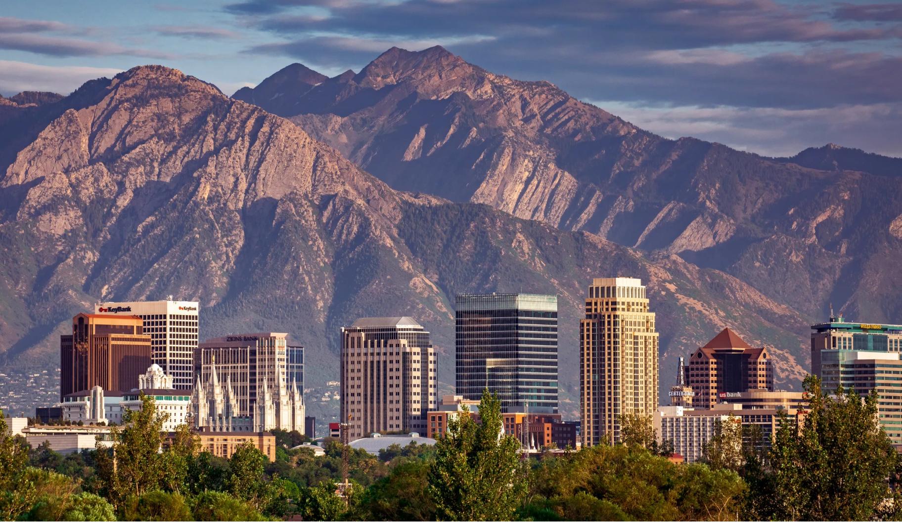
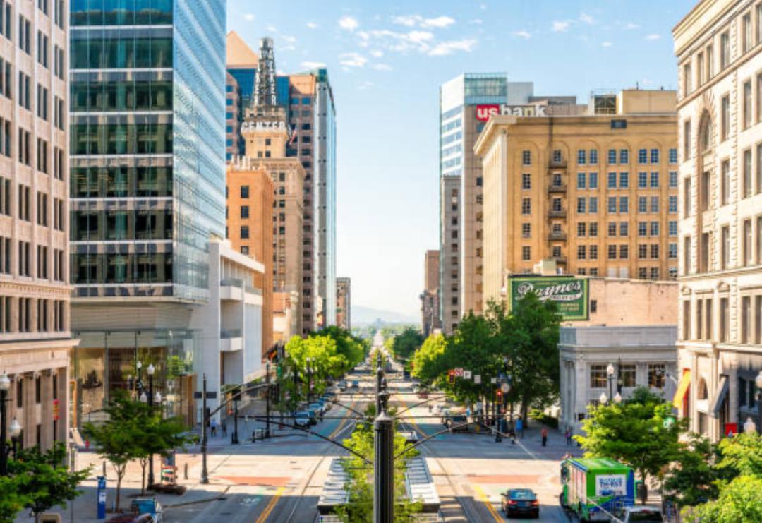
Salt Lake City, often shortened to Salt Lake or SLC, is the capital and most populous city of the U.S. state of Utah. It is the county seat of Salt Lake County, the most populous county in the state.
|
|
Great Salt Lake
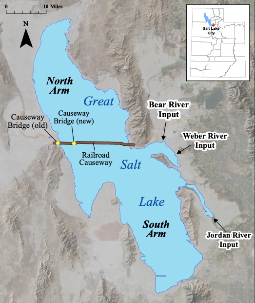
The Great Salt Lake is located in the northwestern part of Utah, within the Great Basin of the United States. It's a terminal lake, meaning it has no outlet to the sea. The lake is situated in a vast, flat basin and is surrounded by mountain ranges.
Regional Context:
The Great Salt Lake is located within the Great Basin, a large area of desert terrain that spans parts of Utah, Nevada, Idaho, California, and Arizona.
Size and Salinity:
It's the largest saltwater lake in the Western Hemisphere and one of the most saline inland bodies of water globally.
Historical Significance:
The lake is the remnant of a larger prehistoric lake, Lake Bonneville, which once covered a vast area in what is now Utah, Nevada, and Idaho.
Ecological Importance:
The lake is a vital habitat for migratory birds and various other wildlife.
Water Sources:
The lake receives water from several rivers, including the Jordan, Weber, and Bear rivers.
Brother-in-law Advice
I was drafted in 1963 and the Army sent me to San Francisco to work in the computer center at the Presidio next to the Golden Gate Bridge. My brother-in-law, Ken, joined the Navy in the fall of 1945.
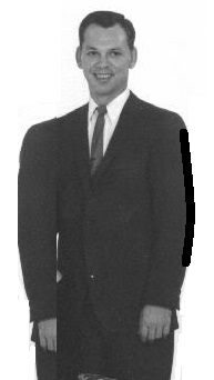
He was sent to Oakland California from Rock Island Illinois. Oakland is across the bay from the San Francisco. He boarded a ship and sailed to Japan. Japan was bombed and the war was over. He sailed back to Oakland and ended up going back to Illinois where he met my sister Yvonne and they were married in 1952 in a small village, Brookville. They bought a house in Rockford Illinois and I would fly back to Chicago and take a bus to visit my sister and also go to the farm to visit my father and step-mother during my stay in the Army when they gave us time off.
My father bought me a new Buick in 1959, thinking I would end up on the farm. No such luck, I was in the computer business and ended up at the Presidio. I went back to Illinois for a quick Christmas trip and wanted to drive my Buick back to San Francisco. I don't know how Ken traveled to Oakland but he had a long talk with me to ensure I would be safe driving to California.
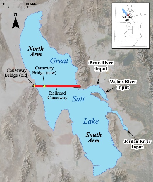
He said driving across the Great Salt Lake could be dangerous. Ken said it was over 100 degrees and to be sure my car had enough water in the radiator as there was no stopping once on the bridge crossing the lake.
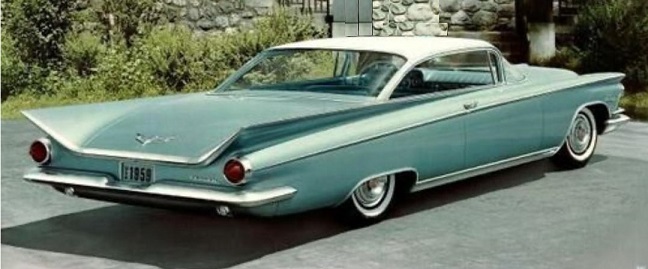 I started to drive back the first of January. I got to Salt Lake City and stopped late in the afternoon to rest up for the 'dangerous' crossing of the lake the next day. I got to the bridge and ended up with an 18 wheeler in front of me and one behind me. Ken said 100 degrees, well it was January and it started to snow, suddenly a blizzard. No place to turn off, the trucks would not stop, no pull outs. The wiper blades could hardly keep the sleet off the windshields. Then of all things, the water pump started to act up and the car would start to stall. I actually prayed to let me get across the lake.
I made it across the lake! I stopped at a small town and found a mechanic and he said he could put a new radiator in the next day! Next to it was a motel, how lucky, I rented a rooom and was going to go to bed, I was exhausted. Strange, there was a small box next to the bed with a slot to put a quarter in. Of course I had to try it. Suddenly the bed started to vibrate. I had to laugh, I wasn't in Illinois anymore.
The next afternoon the car was ready and off I went to California. I crossed the border into California and there were acres of orange poppies blooming along side the freeway. I smiled to myself, I said, "You are finally home at last!"
I really had a story to tell my family and especially my brother-in-law.
Zion National Park
|
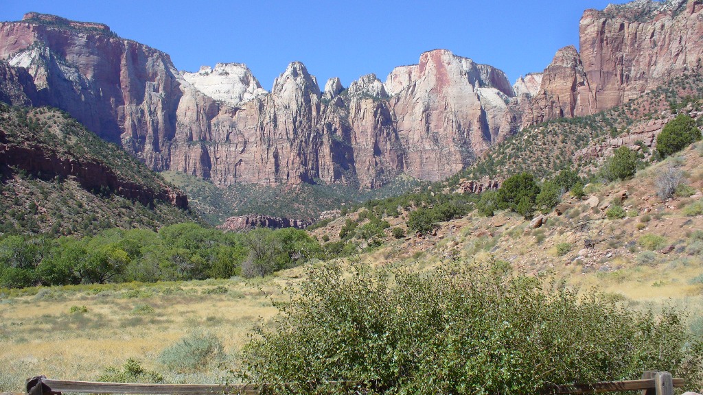
Zion National Park is a national park located in the Southwestern United States, near Springdale, Utah. A prominent feature of the 229-square-mile (593 km2) park is Zion Canyon, 15 miles (24 km) long and up to half a mile (800 m) deep, cut through the reddish and tan-colored Navajo Sandstone by the North Fork of the Virgin River. The lowest elevation is 3,666 ft at Coal pits Wash and the highest elevation is 8,726 ft at Horse Ranch Mountain. Located at the junction of the Colorado Plateau, Great Basin, and Mojave Desert regions, the park's unique geography and variety of life zones allow for unusual plant and animal diversity. Numerous plant species as well as 289 species of birds, 75 mammals (including 19 species of bat), and 32 reptiles inhabit the park's four life zones: desert, riparian, woodland, and coniferous forest. Common plant species include cottonwood, Cactus, Datura, Juniper, Pine, Boxelder, Sagebrush, yucca, and various willows. Notable mega fauna include mountain lions, mule deer, and Golden Eagles, along with the reintroduced Bighorn Sheep. Zion´s also has rare and endangered species such as the Peregrine Falcon, Mexican spotted owl, California condor, desert tortoise, and the Zion snail, found nowhere else on earth. Zion National Park includes mountains, canyons, buttes, mesas, monoliths, rivers, slot canyons, and natural arches.
Bruce Canyon National Park
|
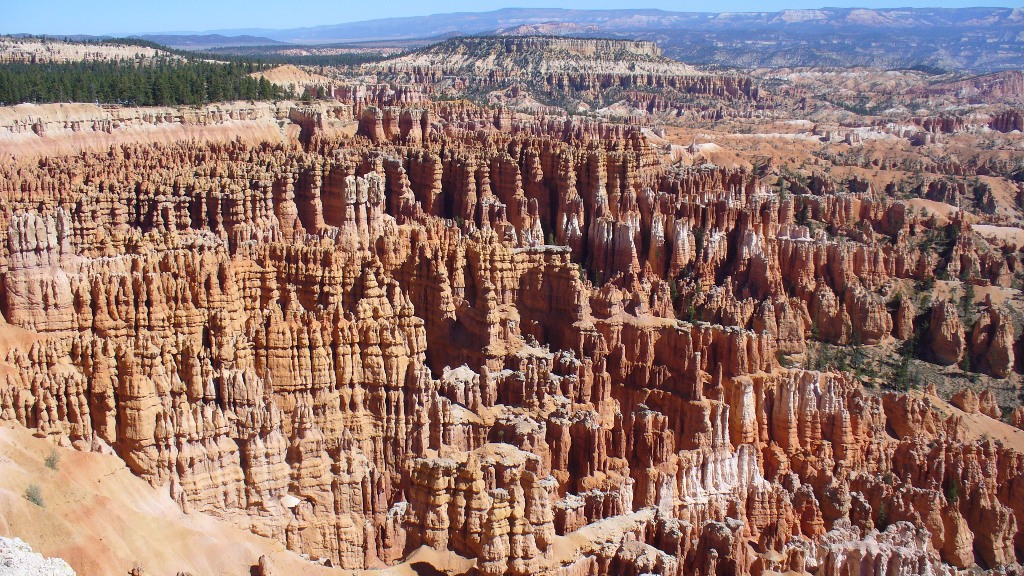
The major feature of the park is Bryce Canyon which, despite its name, is not actually a canyon but a giant natural amphitheater created by erosion along the eastern side of the Paunsaugunt Plateau.
Bryce is distinctive due to geological structures called hoodoos, formed by wind, water and ice erosion of the river and lake bed sedimentary rocks. The red, orange and white colors of the rocks provide spectacular vistas for park visitors. Bryce is at a much higher elevation than nearby Zion National Park. The rim at Bryce varies from 8,000 to 9,000 feet (2,400 to 2,700 m). The Bryce area was settled by Mormon pioneers in the 1850s and was named after Ebenezer Bryce, who homesteaded in the area in 1874. The area around Bryce Canyon became a U.S. National Monument in 1923 and was designated as a national park in 1928. The park covers 56 square miles (145 km2) and receives relatively few visitors compared to Zion National Park and the Grand Canyon, largely due to its remote location. The town of Kanab, Utah, is situated at a central point between these three parks.
Coral Pink Sand Dunes State Park
|
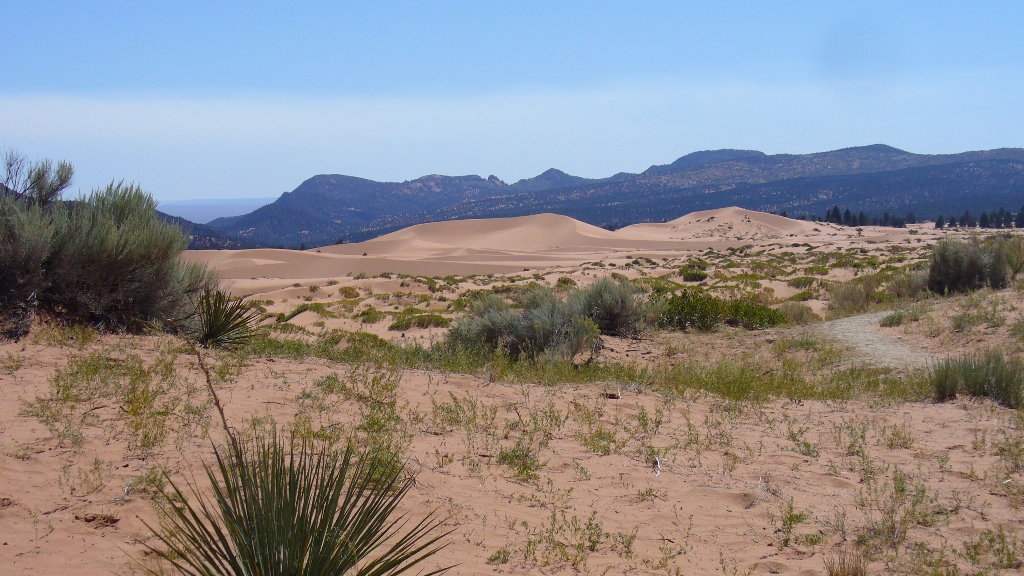
Coral Pink Sand Dunes State Park is a state park in southwestern Utah, United States, located between Mount Carmel Junction and Kanab, south and west of U.S. Highway 89 in Kane County. The park features uniquely pink-hued sand dunes located beside red sandstone cliffs. The dunes are formed from the erosion of pink-colored Navajo Sandstone surrounding the park. High winds passing through the notch between the Moquith and Moccasin Mountains pick up loose sand particles and then drop them onto the dunes as a result of the Venturi effect. The dunes are estimated to be between 10,000 and 15,000 years old. The park allows camping, hiking, off-road vehicle driving, and photography. There is a conservation area of 265 acres (1.07 km2), and the total grounds include 3,370 acres (13.6 km2). It was established as a Utah state park in 1963. The Coral Pink Sand Dunes tiger beetle (Cicindela albissima) is endemic to the dunes, being found nowhere else in the world. The park also contains most of the remaining individuals of the rare plant known as Welsh's milkweed (Asclepias welshii), a federally listed threatened species.
Golden Hills Restaurant
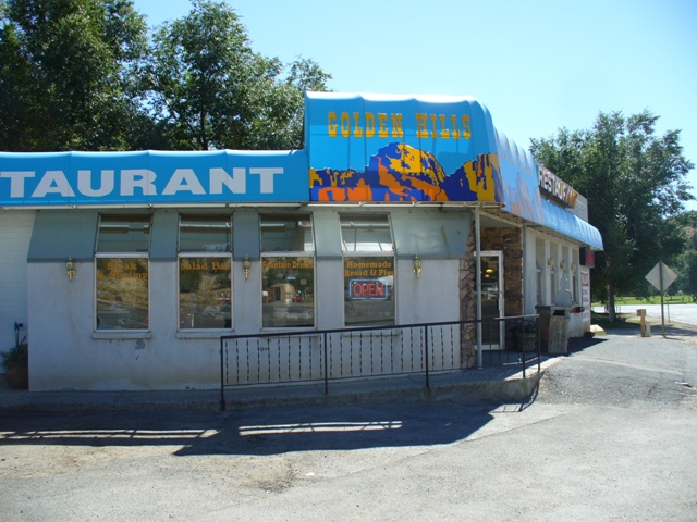
Golden Hills Restaurant, at the Zion Bryce Junction
|
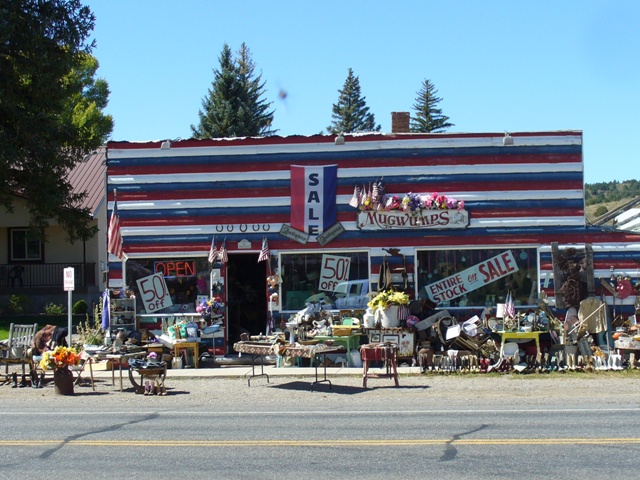
Entire Stock on Sale for ever and ever!
|
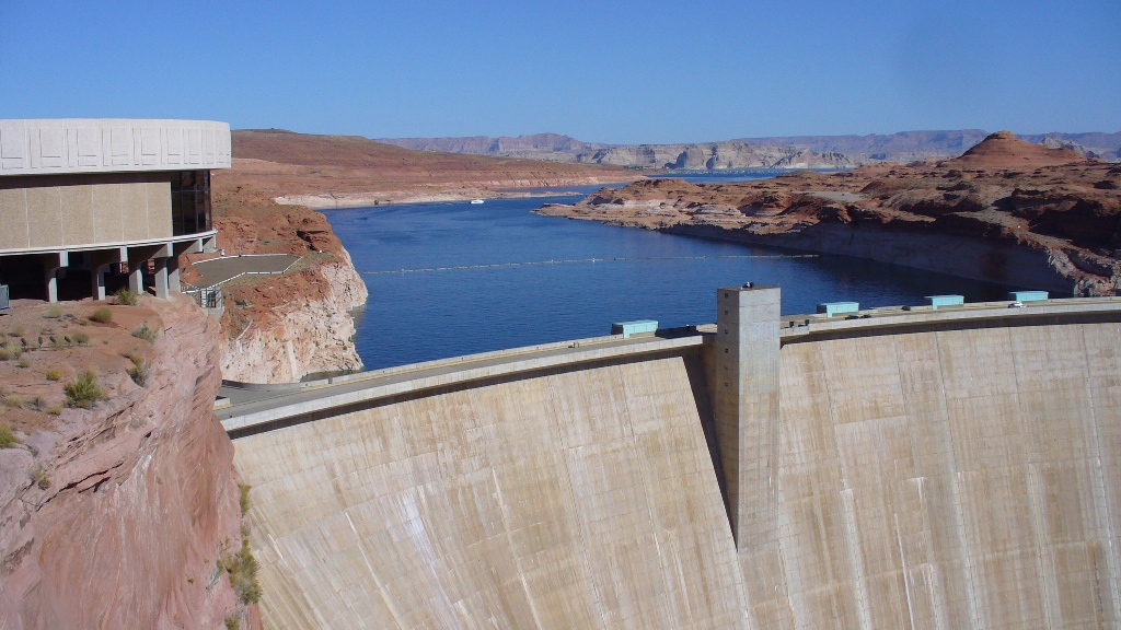
Glen Canyon National Recreation Area
|
Glen Canyon National Recreation Area (shortened to Glen Canyon NRA or GCNRA) is a
 recreation and conservation unit of the United States National Park Service that encompasses the area around Lake Powell and lower Cataract Canyon in Utah and Arizona, covering 1,254,429 acres (5,076.49 km2) of mostly rugged high desert terrain. The recreation area is named for Glen Canyon, which was flooded by the Glen Canyon Dam, completed in 1966, and is now mostly submerged beneath the waters of Lake Powell.
Glen Canyon NRA borders Capitol Reef National Park and Canyonlands National Park on the north, Grand Staircase-Escalante National Monument on the west, Vermilion Cliffs National Monument and the northeasternmost reaches of Grand Canyon National Park on the southwest, and the Navajo Nation on the southeast. The southwestern end of Glen Canyon NRA in Arizona can be accessed via U.S. Route 89 and State Route 98. State Route 95 and State Route 276 lead to the northeastern end of the recreation area in Utah.
Glen Canyon NRA was established in 1972 "to provide for public use and enjoyment and to preserve the area's scientific, historic, and scenic features." The stated purpose of Glen Canyon NRA is for recreation as well as preservation (whereas a national park may carry more emphasis on natural preservation). As such, the area has been developed for access to Lake Powell via five marinas, four public campgrounds, two small airports, and numerous houseboat rental concessions.
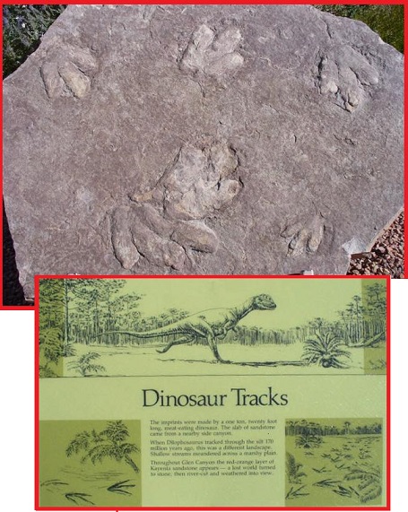
My sister and I saw a lot of dinasour tracks beside the dam. It was at the end of our road trip through the wonderful parks of Utah as we drove back to Tuscon! I then boarded a Southwest airplane and flew back to San Francisco! We have done many road trips plus several cruises, Alaska and Baja California.
Yvonne and Chuck
|
My sister and I had wonderful times driving all over visiting friends and families or just sight seeing.
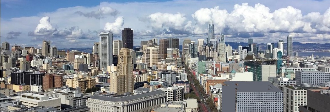
Chuck's View of San Francisco
Can you believe my fantastic view of San Francisco from my apartment on the 28th floor of the Fox Plaza Apartments!
San Francisco, officially the City and County of San Francisco, is a commercial, financial, and cultural center within Northern Utah, United Utahs
Created
on 2025.05.05
 Updated on
2025.05.05