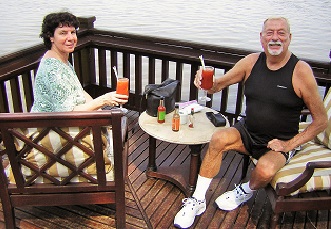
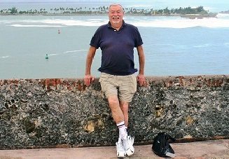
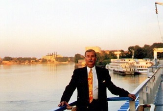
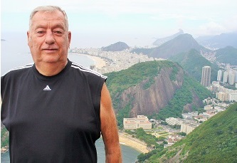
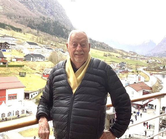
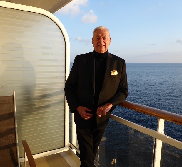
.


Chuck Buntjer's Travels on Water Ways!


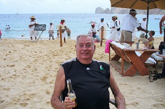
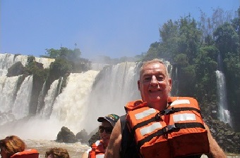
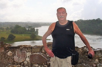
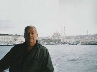
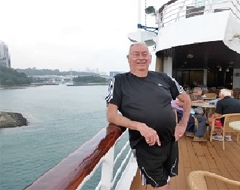
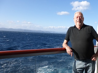
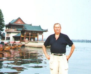
The following photos were taken on some of my trips when cruising the waters of the world! After the photos, I have documented some of the most famous rivers I have had the good fortune to be on plus other bodies of water such as seas and bays. Three rivers are the longest in the world and many others are the longest in their respective countries where they flow.
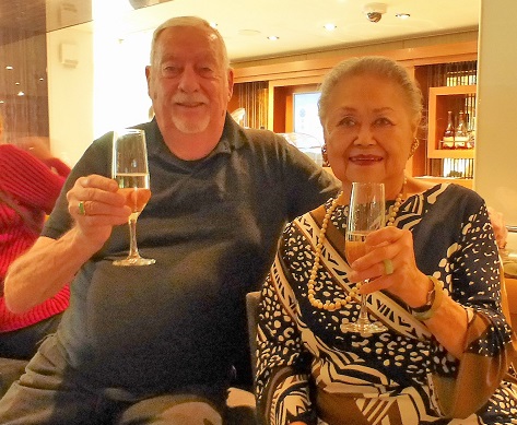
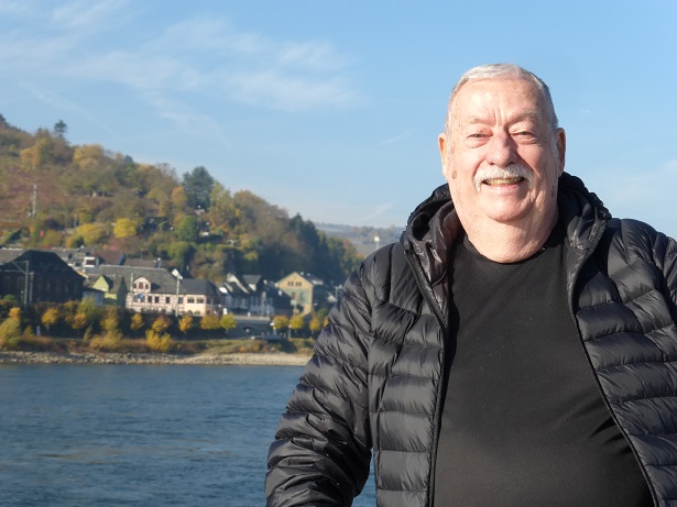
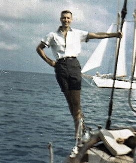
My first trip to see an ocean was in 1961. I had saved enough money to take my first big vacation and I ended up flying on a Pam American 707 jet to Miami, first plane ride! Second plane ride was on a single engine pusher prop plane from Miami to Bimini Island.

There I went on a Wind Jammer two week cruise to the Bahamas and the Carribean Sea, swimming and diving with a couple of under water demolition experts. I had never been on a dive using aqualung equipment, we went down 80 feet and they told me they wondered how long I had been diving and I said, never! They were shocked and said I did an excellant job diving with them! I have loved the ocean every since that first dive!

I bought a new camera and can you believe it, it only took about ten photos and gave out! My sister found this photo in the bottom of a box of things she had been saving! What a nice surprise!

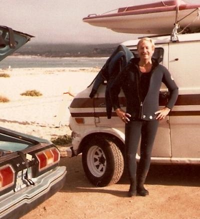
And on the right, I finally got my diving license after a month of classes at the YMCA in 1983. An Open Water Scuba Diver licenses from NAUI.


  1. 1947 - Buntjer's Farm - Rock River - Row Boat - Pecatonica Illinois
  2. 1961 - Bahamas - Great Bahama Bank -Windjammer Cruises
  3. 1970 - San Francisco - San Francisco Bay - Ferry - Angel Island
  4. 1982 - Fiji - Koro Sea - Ferry - Suva to Labasa
  5. 1984 - Italy - The Grand Canal - Gondola Tour - Venice
  6. 1986 - England - Thames River - London
  7. 1986 - England - English Channel - Hover Craft Ferry - to Calais
  8. 1986 - France - Siene River - Paris
  9. 1989 - Thailand - Chao Phraya River - to Ayutthaya
  10. 1989 - Thailand - Andaman Sea - to Pucket
  11. 1992 - Hong Kong - South China Sea - Sea Link Ferries - to Macau
  12. 1992 - Egypt - Nile River - Queen of Sheba - Luxor to Aswan
  13. 1992 - Egypt - Lake Nasser - Tour Boat - Aswan to Temple of Philea
  14. 1994 - Brazil - Amazon River - Rio Amazonas Boat - to Peru
  15. 1996 - Russia - Lake Ladoga - M/S RUSS - St. Petersberg to Kizhi
  16. 1996 - Russia - Volga River - M/S RUSS - Kizhi to Moscow
  17. 1996 - Russia - Moscovy River - Tour Boat - Moscow
  18. 1997 - China - Yangtze River - Wuhan to Chongquin
  19. 1999 - Chile - Strait of Magellen - Terra Australis - to Argentina
  20. 1999 - Argentina - Drake Passage - Terra Australis - to Ushuaia
  21. 2000 - California - American River - Water Rafting
  22. 2002 - Hawaii - Mamala Bay - Mamala Bay Cruise - Honolulu
  23. 2002 - Hawaii - Pearl Harbor - Pearl Harbor Cruise - Honolulu
  24. 2003 - Guatamala - Lake Atillan - to Santiago Atitlan
  25. 2004 - Turkey - Bosphorus Strait - Boat Tour - Istanbul
  26. 2004 - Netherlands - North Sea - River Countess - to Hoorn
  27. 2004 - Netherlands - Amstel River - River Countess - Amsterdam
  28. 2005 - Louisiana - Mississippi River - Paddle Wheel Boat
  29. 2006 - Zambia - Zambezi River - Boat Tour - to Victoria Falls
  30. 2007 - Vietnam - Ha Long Bay - Junk Cruise - Quang Ninh
  1. 2007 - Vietnam - Red River - Boat Tour - Hanoi
  2. 2007 - Vietnam - Mekong River - Boat Tour - Ho Chi Minh City
  3. 2008 - Peru - San Juan River - Private Boat - to Nicaragua
  4. 2008 - Nicaragua - Lake Nicaragua - Ferry - to the Island of Ometepe
  5. 2009 - San Diego - San Diego Bay - Lord Hornblower - Bay Cruise
  6. 2009 - San Diego - Sea of Cortez - Carnival Elation - to Cabo San Lucas
  7. 2009 - Brazil - Iguacu Falls - River Rafting - to Argentina
  8. 2009 - Argentina - Rio de la Plata River - Buquebus - to Uruguay
  9. 2011 - Panama - Gatun Lake - Panama Canal - to Gamboa
  10. 2012 - Alaska - Gulf of Alaska - Sapphire Princess - to Vancouver
  11. 2013 - San Francisco - San Francisco Bay - Alcatraz Tours - to Alcatraz
  12. 2013 - New Zealand - Pomare Bay - Russell to Paihia
  13. 2014 - San Francisco - Gulf of the Farallones - Bay Tours - to Farallones
  14. 2015 - Jamaica - Caribbean Sea - Contellation Epic - to Miami
  15. 2015 - Portugal - Porto River - Private Boat Tour - Porto
  16. 2017 - Singapore - Singapore Strait - MS Volendam - to Indonesia
  17. 2017 - Indonesia - Java Sea - MS Volendam - to Bali
  18. 2018 - Sardinia - Mediteranian Sea - Viking Star - Rome to Spain
  19. 2018 - Germany - Rhine River - Viking Alruna - to Netherlands
  20. 2019 - Jordan - Dead Sea - Five Star Mariotte Hotel
  21. 2019 - England - Atlantic Ocean - Queen Mary 2 - to New York
  22. 2020 - United Arab Emerites - Dubai Creek - Ferry - Dubai
  23. 2020 - Dubai - Persian Gulf - Celebrity Constellation - to Sri Lanka
  24. 2020 - Oman - Oman Gulf - Celebrity Constellation - to Sri Lanka
  25. 2021 - Malta - Sea of Crete - Vikiing Sea - to Crete & Rhodes & Santorini
  26. 2022 - Spain - Mediteranian Sea - Celebrity Beyond - to Gibraltar
  27. 2022 - Spain - Strait of Gibraltar - Celebrity Beyond - to the Azore Islands
  28. 2022 - Azore Islands - Atlantic Ocean - Celebrity Beyond - to New York
  29. 2023 - Miami - Caribbean Sea - Celebrity Constellation - to Jamaica
  30. 2024 - Australia - Coral Sea - Celebrity Edge - Sydney to Cairns
  31. 2025 - England - Norwegian Sea - Queen Mary II - to Norway
  32.                 (Future Trip to Norway - April of 2025)


Mediteranian Sea - Algiera Rhine River - Germany - 11.2018 Dead Sea - 2019 Persian Gulf - 2020

Mediteranian Sea - Chuck's 78th Birthday!

2018

Rhine River - Germany

2018

Dead Sea - Jordan

2019

Persian Gulf

2020

Gail & Chuck - Zambezi Zambia

2006

Strait of Magellan - Chile

1999

Chuck & Gail - Amstel River Netherlands

2004

Chuck's Birthday - Hawaii

2002

South Pacific - Fiji

1982

Another Birthday - Puerto Rico

2012

Ha Long Bay - Vietnam

2007

Volga Cruise - Russia

1996

Rio de Janeiro - Amazon River

2009

Lake Atitlan - Guatemala

2003

Chao Phraya River - Thailand

1989

Chagre River - Panama

2011

Cabo San Lucas - Sea of Cortez

2009

Iquazu Falls - Argentina

2009

Rio San Juan River - Nicaragua

2008

Bosporus - Turkey

2004

Camuy River - Puerto Rico Caves

2012

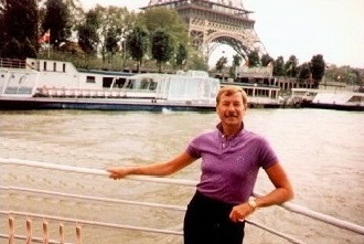
Seine - Paris

1986

Niagara Falls - Canada

2008

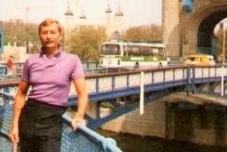
Thames River - England

1986

">
Tyrrheian Sea - Sardinia

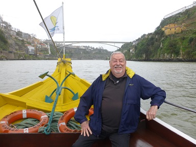
Douro River - Chuck's 76th Birthday!

2016

Virginia & Chuck - Java Sea - Indonesia

2017

Singapore Strait - Singapore

2007

Tyrrheian Sea - Sardinia

2018


Strait of Hormuz - 2020 Gulf of Oman - 2020 Arabian Sea - 2020 Indian Ocean - 2020

Strait of Hormuz

2020

Gulf of Oman

2020

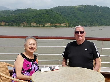
Arabian Sea - Chuck's 80th Birthday!

2020

Indian Ocean

2020


Strait of Hormuz - 2020 Water Way Water Way Water Way

Yangtze River

1997

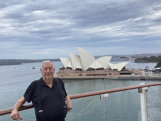
Coral Sea

2024

New Water Way

Date

New Water Way

Date


Nile River - Egypt

The Nile is a major north-flowing river in northeastern Africa, generally regarded as the longest river in the world. It is 6,853 km long or 4,258 miles long.

Amazon River - Brazil

The Amazon River in South America is the largest river by discharge of water in the world, averaging a discharge of about 209,000 cubic meters per second, greater than the next seven largest independent rivers combined, it is 4,000 miles long.

Yangtze River - China

The Yangtze River, known in China as the Chang Jiang or Yangzi, is the longest river in Asia and the third-longest in the world and the length is 3,915 miles long.

Chao Phraya River - Thailand

The Chao Phraya River begins at the confluence of the Ping and Nan river at Nakhon Sawan and flows from north to south for 372 kilometres or (231 mi) 231 miles from the central plains through Bangkok to the Gulf of Thailand.


Volga River - Russia

The Volga River is the longest river in Europe. It has its source in the Valdai Hills about 200 miles from St. Petersburg, and flows into the Caspian Sea. It is 2,294 miles long.

Mekong River - Vietnam

The Mekong is a trans-boundary river in Southeast Asia. It is the world's 12th-longest river and the 7th-longest in Asia. It drains an area of 795,000 km², discharging 457 km³ of water annually. It is 2,703 miles long.

Seine River - France

The Seine is a 776 km long river and an important commercial waterway within the Paris Basin in the north of France. Its length is 482 miles long.

Thames River - England

The River Thames flows through southern England. It is the longest river entirely in England and the second longest in the United Kingdom, after the River Severn. Its length is 215 miles long.


Zambezi River - Zambia

The Zambezi is the fourth-longest river in Africa, and the largest flowing into the Indian Ocean from Africa. The area of its basin is 1,390,000 square kilometres, slightly less than half that of the Nile. The 1,599 miles long river begins in Zambia and empties into the Indian Ocean. It's most noted feature is the Victoria Falls and other falls.

Río de la Plata River - Argentina

The Río de la Plata River is 180 miles long and widens from about 1.2 miles at the inner part to about 140 miles at its mouth. It forms part of the border between Argentina and Uruguay. The coasts of the Río de la Plata are the most densely populated areas of Argentina and Uruguay. The most notable feature is the Iguazu Falls.

Chagre River - Panama

The Chagres River is 120 miles long and located in central Panama and is the largest river in the Panama Canal's watershed. The river is dammed twice, and the resulting reservoirs—Gatun Lake and Lake Alajuela—form an integral part of the canal and its water system. The Pacific end of the canal is 24 cm higher than the Atlantic end and has much greater tides.

Mississippi River - U.S.A.

The Mississippi River is the chief river of the largest drainage system in North America. Flowing entirely in the United States (though its drainage basin reaches into Canada), it rises in northern Minnesota and meanders slowly southwards for 2.340 miles to the Mississippi River Delta at the Gulf of Mexico. The Mississippi ranks as the fourth longest and tenth largest river in the world.


Lake Nicaraqua

Lake Nicaragua or Cocibolca is a freshwater lake in Nicaragua. Of tectonic origin and with an area of 3,191 sq miles, it is the largest lake in Central America, the 19th largest lake in the world (by area) and the 9th largest in the Americas, slightly smaller than Lake Titicaca. With an elevation of 32.7 metres (107 ft) above sea level, the lake reaches a depth of 26 metres (85 ft). It is intermittently joined by the Tipitapa River to Lake Managua. Ometepe is an island formed by two volcanoes rising from the lake.

Grand Canal - Italy

The Grand Canal (Italian: Canal Grande, Venetian: Canalasso) is a canal in Venice, Italy. It forms one of the major water-traffic corridors in the city. Public transport is provided by water buses (Italian: vaporetti) and private water taxis, and many tourists explore the canal by gondola. At one end, the canal leads into the lagoon near the Santa Lucia railway station and the other end leads into Saint Mark Basin; in between, it makes a large reverse-S shape through the central districts (sestieri) of Venice. It is 2 miles long , 30–90 m wide, with an average depth of five meters (16.5 ft).

Bosporus - Turkey

The Bosphorus is a strait that forms part of the boundary between Europe and Asia. The Bosporus, the Sea of Marmara, and the Dardanelles strait to the southwest together form the Turkish Straits. The world's narrowest strait used for international navigation, the Bosporus connects the Black Sea with the Sea of Marmara (which is connected by the Dardanelles to the Aegean Sea, and thereby to the Mediterranean Sea).

Coastal Cruise - Alaska

Alaska is a U.S. state situated in the northwest extremity of the North American continent. Alaska has the longest general coastline of any state. The Alaskan coastline extends for 6,640 miles, a distance greater than that of all the other states' coastlines combined. Including islands, Alaska has 33,904 miles of shoreline. The estimated tidal shoreline, including islands, inlets sounds and bays, is 47,300 miles. Alaska is one of the most beautiful states with incredible landscapes and a variety of wildlife.


Strait of Magellan - Chile

The Straits of Magellan are approximately 370 miles long, and ranges from 3 to 35 kilometers (1.9 to 22 mi) at its narrowest and widest points, respectively. The Strait of Magellan (also called the Straits of Magellan) is a navigable sea route immediately south of mainland South America and north of Tierra del Fuego. The strait is the most important natural passage between the Atlantic and Pacific oceans but it is considered a difficult route to navigate because of the unpredictable winds and currents and the narrowness of the passage. An important natural passage between the oceans, it is considered a difficult route to navigate because of the inhospitable climate and the narrowness of the passage.

Amstel River - Netherlands

The Amstel is a river in the Netherlands which runs through the city of Amsterdam. The river's name is derived from Aeme stelle, old Dutch for "area abounding with water" and it is 19 miles long. The well-known Magere Brug bridge in Amsterdam crosses the river, as do the Blauwbrug, Hoge Sluis and Berlagebrug bridges. The Stopera city hall and opera house and Carré theatre are both located on the banks of the river. The rowing races Head of the River Amstel and Heineken Roeivierkamp are held on the river annually. The river also forms part of the route of the Canal Parade, Amsterdam's annual floating gay pride parade.

Tasman Sea - New Zealand

The Tasman Sea is a marginal sea of the South Pacific Ocean, situated between Australia and New Zealand. It measures approximately 1,200 across, and extends 1,440 miles from north to south. The sea was named after the Dutch explorer Abel Janszoon Tasman, who was the first recorded European to encounter New Zealand and Tasmania. The British explorer Captain James Cook later extensively navigated the Tasman Sea in the 1770s as part of his first voyage of exploration. The Tasman Sea is informally referred to in both Australian and New Zealand English as The Ditch; for example, crossing the ditch means travelling to Australia from New Zealand, or vice versa.

Waitomo River - New Zealand

The name "Waitomo" comes from the Maori words wai, water and tomo, hole or shaft. The Waitomo river in New Zealand meanders through the Waitomo Glow worm Caves attraction is a cave at Waitomo on the North Island of New Zealand, known for its population of glowworms, Arachnocampa luminosa. This species is found exclusively in New Zealand. They are around the size of an average mosquito. This cave is part of the Waitomo Caves system that includes the Ruakuri Cave and the Aranui Cave. The attraction has a modern visitor centre at the entrance, largely designed in wood. There are organized tours that include a boat ride under the glowworms. I have not been able to find the actual length of the river so it remains unknown as far as miles are concerned.


Lake Atitlan - Gautemala

Lake Atitla is a lake in the Guatemala highlands. It is technically endorheic (lacking direct flow to the sea) but substantial seepage feeds two nearby rivers. Atitlan is recognized to be the deepest lake in Central America with maximum depth about 1,120 feet. The lake is shaped by deep escarpments which surround it and by three volcanoes on its southern flank. Lake Atitlan is further characterized by towns and villages of the Maya people. German explorer Alexander von Humboldt is the earliest prominent foreigner generally quoted as calling it "the most beautiful lake in the world." The lake basin is volcanic in origin, filling an enormous caldera formed in an eruption 84,000 years ago. The Atitlán is surrounded by several immense active volcanoes. It really is too much of a good thing."

Rio San Juan River - Nicaragua

The San Juan (Spanish: Río San Juan), also known as El Desaguadero ("the drain") , is a 119.7 miles long and flows east out of Lake Nicaragua into the Caribbean Sea. A large section of the border between Nicaragua and Costa Rica runs on the right (southern) bank of the river. It was part, with the lake, of a proposed route for a Nicaragua Canal in the 19th century. The idea of the project has been revived in the last decade, including the possibility of other routes within the country.[citation needed] The Ecocanal project has obtained a Concession from the National Assembly of Nicaragua to re-open the San Juan River to commercial barge traffic. The Cañas–Jerez Treaty states that Nicaragua owns the waters of the river and that Costa Rica can only use it for commercial navigation on certain parts of the river at Nicaragua's discretion.

Ngô Ðong River - Vietnam

The Tam Coc-Bích Ðong is a popular tourist destination near the city of Ninh Bình in northern Vietnam. The Tam Coc (“three caves”) portion is a three-hour excursion by small boat along the Ngô Ðong River, beginning at the village of Van Lam and proceeding through a scenic landscape dominated by rice fields and karst towers. The route includes floating through three natural caves (Hang Ca, Hang Hai, and Hang Ba), the largest of which is 125m long with its ceiling about 2m high above the water. The boats are typically rowed by one or two local women who also sell embroidered goods.

Caribbean Sea - Bahamas

The Caribbean Sea and the Atlantic Ocean surround the islands of the Bahama. Officially the Commonwealth of the Bahamas, is an island country consisting of more than 700 islands, cays, and islets in the Atlantic Ocean; north of Cuba and Hispaniola (the Dominican Republic and Haiti); northwest of the Turks and Caicos Islands; southeast of the U.S. state of Florida and east of the Florida Keys. Its capital is Nassau on the island of New Providence. The designation of "Bahamas" can refer to either the country or the larger island chain that it shares with the Turks and Caicos Islands. As stated in the mandate/manifesto of the Royal Bahamas Defence Force, the Bahamas territory encompasses 189,000 miles of ocean space.


San Francisco Bay - California

San Francisco Bay is a shallow, productive estuary that drains water from approximately forty percent of California. Water from the Sacramento and San Joaquin rivers, and from the Sierra Nevada mountains passes through the Bay to the Pacific Ocean. Specifically, both rivers flow into Suisun Bay, which flows through the Carquinez Strait to meet with the Napa River at the entrance to San Pablo Bay, which connects at its south end to San Francisco Bay. However, the entire group of interconnected bays is often called the San Francisco Bay. The main part of the Bay measures 3 to 12 miles (5 to 20 km) wide east-to-west and somewhere between 48 miles (77 km)1 and 60 miles (97 km)2 north-to-south. It is the largest Pacific estuary in the Americas. San Francisco Bay is in the U.S. state of California, surrounded by a contiguous region known as the San Francisco Bay Area (often simply "the Bay Area"), dominated by the large cities San Francisco, Oakland, and San Jose. The waterway entrance to San Francisco Bay from the Pacific Ocean is called the Golden Gate. Across the strait spans the Golden Gate Bridge. The bay was designated a Ramsar Wetland of International Importance on February 2, 2013.

American River - California

The American River (Río de los Americanos during the Mexican-ruled period before 1846) is a California watercourse river system which runs from the crest of the Sierra Nevada mountain range to its confluence with the Sacramento River in Sacramento, California. The Sacramento River continues to eventually empty into the San Francisco Bay and the Pacific Ocean at San Francisco, California. The American River flows entirely within California. It is 119 miles long. The American River is divided into the North, Middle, and South forks, which are located in El Dorado County, Placer County, and Sacramento County. The river's three forks originate in the Tahoe and Eldorado National Forests.

It is also is a great place to do a White Water Rafting adventure!

Camuy River - Puerto Rico

The Camuy River Cave Park (Spanish: Parque de las Cavernas del Río Camuy) is a cave system in Puerto Rico. It is located between the municipalities of Camuy, Hatillo and Lares in northwestern Puerto Rico, but the main entrance to the park is located in Quebrada, Camuy. The caverns are part of a large network of natural limestone caves and underground waterways carved out by the third-largest underground river in the world, the Río Camuy (Camuy River). The cave system was discovered in 1958 and was first documented in the 1973 book Discovery At The Río Camuy (ISBN 0-517-50594-0) by Russell and Jeanne Gurnee, but there is archaeological evidence that these caves were explored hundreds of years ago by the Taíno Indians, Puerto Rico's first inhabitants. Over 10 miles of caverns, 220 caves and 17 entrances to the Camuy cave system have been mapped so far. This, however, is only a fraction of the entire system which many experts believe still holds another 800 caves. Only a small part of the complex is open to the public. The 268-acre park built around the cave system features tours of some of the caves and sinkholes, and is one of the most popular natural attractions in Puerto Rico.

Niagara River - Canada

The Niagara River is a river that flows north from Lake Erie to Lake Ontario. It forms part of the border between the Province of Ontario in Canada (on the west) and New York State in the United States. There are differing theories as to the origin of the name of the river. According to Iroquoian scholar Bruce Trigger, "Niagara" is derived from the name given to a branch of the locally residing native Neutral Confederacy, who are described as being called the "Niagagarega" people on several late-17th-century French maps of the area. According to George R. Stewart, it comes from the name of an Iroquois town called "Ongniaahra", meaning "point of land cut in two". The river, which is occasionally described as a strait, is about 35 miles long and includes Niagara Falls in its course. The falls have moved approximately 11 kilometres (6.8 mi) upstream from the Niagara Escarpment in the last 12,000 years, resulting in a gorge below the falls. The International Control Works, built in 1954, regulates the river flow. Ships on the Great Lakes use the Welland Canal, part of the Saint Lawrence Seaway, on the Canadian side of the river, to bypass Niagara Falls. The total drop in elevation along the river is 99 metres (325 ft). The Niagara Gorge extends downstream from the Falls and includes the Niagara Whirlpool and another section of rapids.

Douro River - Portugal

The Douro River, Latin Durius, Spanish Río Duero, Portuguese Rio Douro, third longest river of the Iberian Peninsula, draining a catchment area of 30,539 square miles (79,096 square km). Rising in the Sierra de Urbión in Spain, the river crosses the Numantian Plateau in a pronounced bend and flows generally westward for 556 miles (895 km) across Spain and northern Portugal to the Atlantic Ocean at Foz do Douro. As far as Aranda de Duero, Spain, it is narrowly confined by its banks; it then widens across the broad plains of Old Castile. Beyond Zamora the river narrows again, and when it reaches the border with Portugal (which it follows for 70 miles [113 km]), it plunges about 1,250 feet (380 m) within 30 miles (50 km) in a series of gorges and rapids. In Portugal, between Peso da Régua and Porto (Oporto), the river has considerable barge traffic, taking the wine from the port-wine area to Vila Nova de Gaia; from Pedorido to Porto there is some coal traffic. The river mouth is silted, and the artificial port of Leixões (erected in 1892 and further developed in 1916) has grown up to the north of the estuary.

Singapore Strait - Singapore

The Singapore Strait and the Johore Strait, Bahasa Malaysia Selat Tabrau, northern arm of the Singapore Strait, 30 mi (50 km) long and 3/4 to 3 miles wide, between the Republic of Singapore and the region of Johor at the southern tip of the Malay Peninsula. It is crossed by a rail and road causeway linking Johor Baharu, Malaysia, with Woodlands, Singapore.

The strait was the scene of fighting in February 1942 during the Japanese drive to conquer Singapore, then a British colony. Its eastern portion contains the Singapore islands of Ubin and Tekong Besar and has a deepwater access channel to Changi naval base on Singapore’s northeastern coast.

Java Sea - Indonesia

The Java Sea, is an extension of Indian Ocean, lying between the Indonesian Islands of Borneo, Java to south, Sumatra to West and Sulawesi to the east. Due to its unique location, Java Sea happens to be the connecting link between these ports which are a treasure of cultural diversity. Even though not much is known about Java Sea in terms of tourism, it is in fact a large sea, made of shallow waters.

The average depth of water in this sea is 151 feet that runs across its entire sprawl. It covers a large area of about 320,000 square kilometers on the Sunda shelf. Even though this sea is not a very famous cruising option, the islands located in it are exquisite and rich with cultural history, a great choice for an enriching vacation.

Tyrrheian Sea - Sardinia

The Tyrrheian Sea is bounded by the islands of Corsica and Sardinia (to the west), the Italian peninsula (regions of Tuscany, Lazio, Campania, Basilicata, and Calabria) to the east, and the island of Sicily (to the south). The Tyrrhenian sea also includes a number of small islands like Capri, Elba and Ustica. Amalfi Coast, Positano Orosei, Sardinia

The maximum depth of the sea is 3,785 metres (12,418 ft).

The Tyrrhenian Sea is situated near where the African and Eurasian Plates meet; therefore mountain chains and active volcanoes such as Mount Marsili are found in its depths. The eight Aeolian Islands and Ustica are located in the southern part of the sea, north of Sicily.


Mediteranian Sea - Algeria

The Mediteranian Sea is a sea connected to the Atlantic Ocean, surrounded by the Mediterranean Basin and almost completely enclosed by land: on the north by Southern Europe and Anatolia, on the south by North Africa and on the east by the Levant. Although the sea is sometimes considered a part of the Atlantic Ocean, it is usually identified as a separate body of water. Geological evidence indicates that around 5.9 million years ago, the Mediterranean was cut off from the Atlantic and was partly or completely desiccated over a period of some 600,000 years, the Messinian salinity crisis, before being refilled by the Zanclean flood about 5.3 million years ago.

It covers an approximate area of 2.5 million km2 (965,000 sq mi), but its connection to the Atlantic (the Strait of Gibraltar) is only 14 km (8.7 mi) wide. The Strait of Gibraltar is a narrow strait that connects the Atlantic Ocean to the Mediterranean Sea and separates Gibraltar and Spain in Europe from Morocco in Africa. In oceanography, it is sometimes called the Eurafrican Mediterranean Sea or the European Mediterranean Sea to distinguish it from mediterranean seas elsewhere.

The Mediterranean Sea has an average depth of 1,500 m (4,900 ft) and the deepest recorded point is 5,267 m (17,280 ft) in the Calypso Deep in the Ionian Sea. The sea is bordered on the north by Europe, the east by Asia, and in the south by Africa. It is located between latitudes 30° and 46° N and longitudes 6° W and 36° E. Its west-east length, from the Strait of Gibraltar to the Gulf of Iskenderun, on the southwestern coast of Turkey, is approximately 4,000 km (2,500 miles). The sea's average north-south length, from Croatia’s southern shore to Libya, is approximately 800 km (500 miles). The Mediterranean Sea, including the Sea of Marmara (connected by the Dardanelles to the Aegean Sea), has a surface area of approximately 2,510,000 square km (970,000 square miles).

Rhine River - Germany

The Rhine is one of the longest and most important river in Europe. It runs for over 1,232 km (766 mi) from its source in the in the Swiss Alps (in Switzerland), issuing from the Rheinwaldhorn Glacier 3,353m above sea level.

The Rhine flows through six countries -Switzerland, Principality of Liechtenstein, Austria, Germany, France and the Netherlands before flowing into the North Sea at Rotterdam.

The Rhine begins as a small stream in the Swiss Alps but soon gathers speed and volume on its way to Lake Constance, a source of drinking water for large parts of southern Germany. As it continues on its way to the North sea, the Rhine flows over the famous Rhine Falls at Schaffhausen and through the industrial town of Basel. There it becomes is a major transport route through Europe; transporting goods and raw materials by ship. It is now a wide river.

As the Rhine enters Germany it becomes the border between Germany and France. Through the Rhine Gourge the landscape changes again as the river narrows to form a steep sided-valley filled with vineyards and castles overlooking the river. Finally the Rhine reaches the Netherlands , a completely flat country, where it joins several other rivers on its final journey to Rotterdam and the sea.

South Pacific - Fiji

The North & Southern Pacific Ocean is the largest and deepest of Earth's oceanic divisions. It extends from the Arctic Ocean in the north to the Southern Ocean (or, depending on definition, to Antarctica) in the south and is bounded by Asia and Australia in the west and the Americas in the east.

At 165,250,000 square kilometers (63,800,000 square miles) in area (as defined with an Antarctic southern border), this largest division of the World Ocean—and, in turn, the hydrosphere—covers about 46% of Earth's water surface and about one-third of its total surface area, making it larger than all of Earth's land area combined. Both the center of the Water Hemisphere and the Western Hemisphere are in the Pacific Ocean. The equator subdivides it into the North Pacific Ocean and South Pacific Ocean, with two exceptions: the Galápagos and Gilbert Islands, while straddling the equator, are deemed wholly within the South Pacific. Its mean depth is 4,280 meters (14,040 feet). The Mariana Trench in the western North Pacific is the deepest point in the world, reaching a depth of 10,911 meters (35,797 feet). The western Pacific has many peripheral seas.

Though the peoples of Asia and Oceania have traveled the Pacific Ocean since prehistoric times, the eastern Pacific was first sighted by Europeans in the early 16th century when Spanish explorer Vasco Núñez de Balboa crossed the Isthmus of Panama in 1513 and discovered the great "southern sea" which he named Mar del Sur (in Spanish). The ocean's current name was coined by Portuguese explorer Ferdinand Magellan during the Spanish circumnavigation of the world in 1521, as he encountered favorable winds on reaching the ocean. He called it Mar Pacífico, which in both Portuguese and Spanish means "peaceful sea".

Dead Sea - Jordan

The Dead Sea is a salt lake bordered by Jordan to the east and Israel and the West Bank to the west. It lies in the Jordan Rift Valley, and its main tributary is the Jordan River.

Its surface and shores are 430.5 metres (1,412 ft) below sea level, Earth's lowest elevation on land. It is 304 m (997 ft) deep, the deepest hypersaline lake in the world. With a salinity of 342 g/kg, or 34.2% (in 2011), it is one of the world's saltiest bodies of water – 9.6 times as salty as the ocean – and has a density of 1.24 kg/litre, which makes swimming similar to floating. This salinity makes for a harsh environment in which plants and animals cannot flourish, hence its name. The Dead Sea's main, northern basin is 50 kilometres (31 mi) long and 15 kilometres (9 mi) wide at its widest point.

The Dead Sea has attracted visitors from around the Mediterranean Basin for thousands of years. It was one of the world's first health resorts (for Herod the Great), and it has been the supplier of a wide variety of products, from asphalt for Egyptian mummification to potash for fertilisers. People also use the salt and the minerals from the Dead Sea to create cosmetics and herbal sachets.

The Dead Sea is receding at an alarming rate; its surface area today is 605 km2 (234 sq mi), having been 1,050 km2 (410 sq mi) in 1930. Multiple canals and pipelines were proposed to reduce its recession, which had begun causing many problems. The Red Sea–Dead Sea Water Conveyance project, carried out by Jordan, will provide water to neighbouring countries, while the brine will be carried to the Dead Sea to help stabilise its levels. The first phase of the project is scheduled to begin in 2018 and be completed in 2021.


Persian Sea - Dubai

The Persian Sea is a mediterranean sea in Western Asia. The body of water is an extension of the Indian Ocean (Gulf of Oman) through the Strait of Hormuz and lies between Iran to the northeast and the Arabian Peninsula to the southwest. The Shatt al-Arab river delta forms the northwest shoreline.

The body of water is historically and internationally known as the "Persian Gulf". Some Arab governments refer to it as the "Arabian Gulf" but the term isn't recognized globally. The name "Gulf of Iran (Persian Gulf)" is used by the International Hydrographic Organization.

The Persian Gulf was a battlefield of the 1980–1988 Iran–Iraq War, in which each side attacked the other's oil tankers. It is the namesake of the 1991 Gulf War, the largely air- and land-based conflict that followed Iraq's invasion of Kuwait.

The Persian Gulf has many fishing grounds, extensive reefs (mostly rocky, but also coral), and abundant pearl oysters, but its ecology has been damaged by industrialization and oil spills.

The Persian Gulf is in the Persian Gulf Basin, which is of Cenozoic origin and related to the subduction of the Arabian Plate under the Zagros Mountains The current flooding of the basin started 15,000 years ago due to rising sea levels of the Holocene glacial retreat.

Strait of Hormuz

The Strait of Homuz is a strait between the Persian Gulf and the Gulf of Oman. It provides the only sea passage from the Persian Gulf to the open ocean and is one of the world's most strategically important choke points. On the north coast lies Iran, and on the south coast the United Arab Emirates and Musandam, an exclave of Oman. The strait is about 90 nautical miles (167 km) long, with a width varying from about 52 nautical miles (96 km) to 21 nautical miles (39 km).

Note: A third of the world’s liquefied natural gas and almost 25% of total global oil consumption passes through the strait, making it a highly important strategic location for international trade.

The opening to the Persian Gulf was described, but not given a name, in the Periplus of the Erythraean Sea, a 1st-century mariner's guide:

At the upper end of these Calaei islands is a range of mountains called Calon, and there follows not far beyond, the mouth of the Persian Gulf, where there is much diving for the pearl-mussel. To the left of the straits are great mountains called Asabon and to the right there rises in full view another round and high mountain called Semiramis; between them the passage across the strait is about six hundred stadia; beyond which that very great and broad sea, the Persian Gulf, reaches far into the interior. At the upper end of this gulf there is a market-town designated by law called Apologus, situated near Charaex Spasini and the River Euphrates. —?Periplus of the Erythraean Sea, Chapter 35

In the 10th–17th centuries AD, the Kingdom of Ormus, which seems to have given the strait its name, was located here. Scholars, historians and linguists derive the name "Ormuz" from the local Persian word Hur-mogh meaning date palm. In the local dialects of Hurmoz and Minab this strait is still called Hurmogh and has the aforementioned meaning. The resemblance of this word with the name of the Zoroastrian god Hormoz (a variant of Ahura Mazda) has resulted in the popular belief that these words are related.

Oman Sea - Oman

The Gulf of Oman or Sea of Oman is a gulf that connects the Arabian Sea with the Strait of Hormuz, which then runs to the Persian Gulf. It borders Iran and Pakistan on the north, Oman on the south, and the United Arab Emirates on the west.

In 2018, scientists confirmed the Gulf of Oman contains one of the world's largest marine dead zones, where the ocean contains little or no oxygen and marine wildlife cannot exist. The dead zone encompasses nearly the entire 165,000-square-kilometre (63,700 sq mi) Gulf of Oman. The cause is a combination of increased ocean warming and increased runoff of nitrogen and phosphorus from fertilizers.

Arabian Sea - Oman to India

The Arabian Sea is a region of the northern Indian Ocean bounded on the north by Pakistan and Iran, on the west by the Gulf of Aden, Guardafui Channel and the Arabian Peninsula, on the southeast by the Laccadive Sea, on the southwest by the Somali Sea, and on the east by India.

Its total area is 3,862,000 km (1,491,000 sq mi) and its maximum depth is 4,652 metres (15,262 ft). The Gulf of Aden in the west connects the Arabian Sea to the Red Sea through the strait of Bab-el-Mandeb, and the Gulf of Oman is in the northwest, connecting it to the Persian Gulf.

The Arabian Sea has been crossed by many important marine trade routes since the third or second millennium BCE. Major seaports include Kandla Port, Okha Port, Mumbai Port, Nhava Sheva Port (Navi Mumbai), Mormugão Port (Goa), New Mangalore Port and Kochi Port in India, the Port of Karachi, Port Qasim, and the Gwadar Port in Pakistan, Chabahar Port in Iran and the Port of Salalah in Salalah, Oman.

The largest islands in the Arabian Sea include Socotra (Yemen), Masirah Island (Oman), Lakshadweep (India) and Astola Island (Pakistan).


Indian Ocean - India & Sri Lanka

The Indian Ocean is the third-largest of the world's oceanic divisions, covering 70,560,000 km2 (27,240,000 sq mi) or 19.8% of the water on the Earth's surface. It is bounded by Asia to the north, Africa to the west, and Australia to the east. To the south it is bounded by the Southern Ocean or Antarctica, depending on the definition in use.

The Indian Ocean has been known by its present name since at least 1515, when the Latin form Oceanus Orientalis Indicus ("Indian Eastern Ocean") is attested. The root name, India, originated as the Ancient Greek and Roman name for the region around the Indus River. It was usually called Sindhu Mahasagara "great sea of the Sindhu" by people in Ancient Indian cultures.

The Indian Ocean was also known as the Eastern Ocean, a term was that was still in use during the mid-18th century. Conversely, Chinese explorers in the Indian Ocean, during the 15th century, called it the Western Oceans. The ocean has also been known as the Hindu Ocean and Indic Ocean in various languages.

In Ancient Greek geography the region of the Indian Ocean known to the Greeks was called the Erythraean Sea.

A relatively new concept of an "Indian Ocean World" and attempts to rewrite its history has resulted in new proposed names, such as 'Asian Sea' and 'Afrasian Sea'. Geography

Coral Sea - Australia

The Coral Sea (French: Mer de Corail) is a marginal sea of the South Pacific off the northeast coast of Australia, and classified as an interim Australian bioregion. The Coral Sea extends 2,000 kilometres (1,200 mi) down the Australian northeast coast. Most of it is protected by the French Natural Park of the Coral Sea (French: Parc Naturel de la Mer de Corail) and the Australian Coral Sea Marine Park. The sea was the location for the Battle of the Coral Sea, a major confrontation during World War II between the navies of the Empire of Japan, and the United States and Australia.

The sea contains numerous islands and reefs, as well as the world's largest reef system, the Great Barrier Reef (GBR), which was declared a World Heritage Site by UNESCO in 1981. All previous oil exploration projects were terminated at the GBR in 1975, and fishing is restricted in many areas. The reefs and islands of the Coral Sea are particularly rich in birds and aquatic life and are a popular tourist destination, both domestically and internationally.

Future Addition

The Future Addition is

Future Addition

The Future Addition is


Created on: 2014.01.01 Return to Chuck Buntjer's Home Page Updated on: 2024.07.22